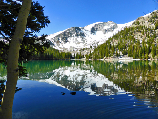
The high country is starting to open up and our favorite alpine trails are becoming runnable once again. Here are a few trails in the valley that are great options right now.
Thomas Lakes
This is a great run that offers up awe inspiring views of Mt Sopris. The trail to the lakes is currently snow free although you probably won’t be able to make it too much further up Sopris without encountering ample amounts of snow.
The trail climbs steadily in mixed timber to a gate (1.15 miles : 9,230′). It bends south and levels across open shrubland slopes with great views down W. Sopris Creek and out to Hay Park.
Bear right at the Hay Park – Thomas Lakes Trail split (1.7 miles : 9,370′) and rise through open space to an elevated meadow with great views of Mount Sopris (2.0 miles : 9,595′). The trail enters a tall aspen forest and moderates to a string of glades (2.9 miles : 9,850′) that open to big meadows along Prince Creek (3.2 miles : 9,980′).
It crosses Prince Creek and passes between a pond and large clearing (3.5 miles : 10,135′) to the Maroon Bells Wilderness Boundary and first Thomas Lake (3.8 miles : 10,197′). The trail forks here to designated campsites – follow signs for Mount Sopris to reach the second Thomas Lake (4.0 miles : 10,248′).
The first lake is ringed by rugged talus that can limit exploration. Improvise across the outlet to open-rock shores where you’ll find few people, excellent views and raspberries popping through the talus. The second lake fills a level (albeit rocky) basin with good access for anglers and more room to explore.
Avalanche is not clear all the way to the pass at 12k, but you should be able to make it up a good 7 miles or so and enjoy some of the amazing views that this trail has to offer. The Avalanche Lake Trail begins from the parking lot and ascends through aspen groves, intersecting with the Hell Roaring Trail after about 2.5 miles. Keep straight here as the trail crosses Hell Roaring Creek before descending a few hundred vertical toward Avalanche Creek. If you are going out and back, pace accordingly as climbing back out of here can be a bit of a grind. After 5 miles, the trail crosses a beautiful meadow called Duley Park before entering groves of ginormous aspens. After another 2 miles or so, look for the intersection with East Creek Trail.
Conundrum Hot Springs
The trail to the springs is pretty darn dry right now. This is a great way to get up high and get some awesome views of a few snow covered peaks. The hot springs are pretty nice as well.
While the springs are the main attraction, the hike in is equally compelling. The Conundrum Creek Trail runs through long stretches of level meadows, aspen forests and valley openings to the springs, with abundant wildlife and open space that’s notable for even this expansive wilderness.
The trail dips and rises across a broad meadow that funnels into conifer and aspen along the creek (1.0 miles : 8,970′). It emerges in a small meadow at 1.75 miles, then the first of several major meadows at 1.85 miles (9,240′).
Travel is quick to a bridge leading to the west side of the creek (2.75 miles : 9,390′). The bridge is elevated and narrow – consider crossing in the water if slick or carrying a heavy pack. Mild grades continue across a second large meadow at 3.85 miles (9,550′), past which it steepens on rugged terrain above a deep gorge in the valley (4.5 miles).
The trail enters a third major meadow at 4.8 miles that stretches (with brief interruption) to a bridge leading east to the Silver Ponds (6.0 miles : 10,240′). Note dogs are not permitted beyond this point.
The trail skirts marshy ponds to a marked creek ford back to the west side (6.55 miles : 10,320′). The ford can be voluminous at peak runoff, but is generally safe and easy. The trail opens across atalus field with your first clear view of the upper valley (7.2 miles : 10,455′).
It steepens away in a cluttered forest to a sign on the hot springs perimeter (8.15 miles : 10,965′). The trail hops a creek braid and opens past spurs for designated sites to the split for Triangle Pass. The Conundrum Hot Springs are located across the creek about 100 yards away (8.5 miles : 11,222′). There’s one large pool and one small pool in the main area where most people congregate. Clothing is optional, and expect a lively crowd.
The springs are at treeline in a valley topped by Cathedral Peak (13,943′), Conundrum Peak(14,022′) and Castle Peak (14,265′), which share a similar geologic make-up and appearance to Maroon Bells. The Conundrum Creek Trail continues 2 miles and 1700′ up to Triangle Pass.

